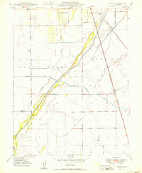
1950 Map of Nelson
USGS Topo · Published 1950About this map
Butte Creek and its complex network of sloughs and irrigation channels define this 1950 survey of the California Central Valley. The landscape reveals a highly engineered agricultural environment where natural features like Esquon Slough and Durham Slough coexist with the Western Canal and Odell Canal. The settlement of Nelson serves as a local hub, situated at the junction of Nelson Road and the Southern Pacific railroad line.
Find a feature on this map
19 named features on this map. Tap any name to fly to it.
Don’t see what you’re looking for? This feature index may not catch every label — zoom into the map to look around manually.
Map Details
Editions of this 1950 Nelson Map
This is the sole edition of this map. No revisions or reprints were ever made.
Other maps of this area

1888 · Marysville
USGS Topo · 1:125,000

1891 · Chico
USGS Topo · 1:125,000

1891 · Marysville
USGS Topo · 1:125,000

1893 · Chico
USGS Topo · 1:125,000

1894 · Marysville
USGS Topo · 1:125,000

1895 · Marysville
USGS Topo · 1:125,000

1895 · Chico
USGS Topo · 1:125,000

1911 · Landlow
USGS Topo · 1:31,680

1912 · Dry Creek
USGS Topo · 1:31,680

1912 · Durham
USGS Topo · 1:31,680