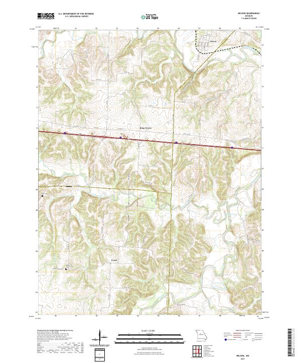
2021 Map of Nelson
USGS Topo · Published 2021About this map
Nelson and its surrounding countryside are defined by the convergence of the Blackwater River and the Lamine River in a landscape where Saline, Cooper, and Pettis counties meet. This agricultural and riverine region features a network of rural roads such as State Hwy AE and State Hwy Z that connect small communities and family landmarks. The map documents the persistent rural character of settlements like Ridge Prairie and the community of Postal. Local history is anchored by sites like Millers Chapel Cem and Raines Cem, which offer significant value for genealogists tracing families in this part of Missouri. The drainage patterns of Heaths Creek, Marlin Cr, and Painter Br carve through the terrain, leading toward larger water bodies like Embry Lake and Goose Lake, illustrating the natural drainage system that has influenced land use and settlement for generations.
Find a feature on this map
55 named features on this map. Tap any name to fly to it.
Don’t see what you’re looking for? This feature index may not catch every label — zoom into the map to look around manually.
Map Details
Editions of this 2021 Nelson Map
This is the sole edition of this map. No revisions or reprints were ever made.
Other maps of this area

1887 · Sedalia
USGS Topo · 1:125,000

1888 · Boonville
USGS Topo · 1:125,000

1890 · Glasgow
USGS Topo · 1:125,000

1890 · Marshall
USGS Topo · 1:125,000

1892 · Marshall
USGS Topo · 1:125,000

1894 · Sedalia
USGS Topo · 1:125,000

1901 · Marshall
USGS Topo · 1:125,000

1940 · Marshall
USGS Topo · 1:62,500

1944 · Marshall
USGS Topo · 1:62,500

1947 · Glasgow
USGS Topo · 1:62,500