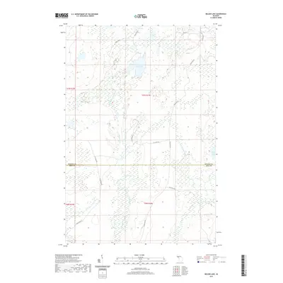
2019 Map of Nelson Lake
USGS Topo · Published 2019About this map
Nelson Lake and Fence Lake anchor a high-country wetland landscape along the boundary of Baraga and Iron counties. This interior portion of the Upper Peninsula is defined by its complex hydrography, where the headwaters of the East Branch Fence River and the W Br Michigamme River begin their descent through the timberlands. The terrain is a mosaic of marshes and small water bodies like Fire Lake and Saint Johns Lake, connected by a network of logging and access routes including Fence River Rd and Cut Across Rd. The drainage patterns of Wilson Cr and Leonard Cr reveal a landscape little changed by permanent settlement, instead serving as a critical watershed for the Michigamme and Fence river systems. Survey lines like the Baraga Co Iron Co border provide the primary structural markers across this wilderness area.
Find a feature on this map
23 named features on this map. Tap any name to fly to it.
Don’t see what you’re looking for? This feature index may not catch every label — zoom into the map to look around manually.
Map Details
Editions of this 2019 Nelson Lake Map
This is the sole edition of this map. No revisions or reprints were ever made.
Other maps of this area

1895 · Ned Lake
USGS Topo · 1:62,500

1899 · Witbeck
USGS Topo · 1:62,500

1955 · Witch Lake
USGS Topo · 1:24,000

1955 · Ned Lake
USGS Topo · 1:62,500

1955 · Herman
USGS Topo · 1:62,500

1955 · Witch Lake NE
USGS Topo · 1:24,000

1955 · Witch Lake
USGS Topo · 1:62,500

1956 · Three Lakes
USGS Topo · 1:24,000

1956 · Michigamme
USGS Topo · 1:62,500

1956 · Michigamme
USGS Topo · 1:24,000