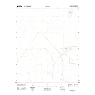
2012 Map of Nelson Lake
USGS Topo · Published 2012About this map
Nelson Lake and McLean Lake define the hydrology of this arid San Bernardino County landscape. This 2012 USGS study documents a network of ephemeral washes and desert terrain punctuated by these two distinct basins. The map captures the specialized geography of the Mojave region, where the drainage patterns suggest a collection of dry lake beds or seasonal pans that only occasionally hold water. The lack of permanent structures or developed settlements indicates a largely undisturbed wilderness area, likely part of a protected or restricted desert corridor, where the topography is defined solely by its natural drainage and minimal road infrastructure.
Find a feature on this map
2 named features on this map. Tap any name to fly to it.
Don’t see what you’re looking for? This feature index may not catch every label — zoom into the map to look around manually.
Map Details
Editions of this 2012 Nelson Lake Map
This is the sole edition of this map. No revisions or reprints were ever made.
Other maps of this area

1933 · Avawatz Mountains
USGS Topo · 1:250,000

1947 · Trona
USGS Topo · 1:250,000

1948 · Trona
USGS Topo · 1:250,000

1948 · Quail Mountains
USGS Topo · 1:62,500

1948 · Leach Lake
USGS Topo · 1:62,500

1948 · Goldstone Lake
USGS Topo · 1:62,500

1948 · Tiefort Mountains
USGS Topo · 1:62,500

1951 · Goldstone Lake
USGS Topo · 1:62,500

1951 · Tiefort Mountains
USGS Topo · 1:62,500

1951 · Quail Mountains
USGS Topo · 1:62,500