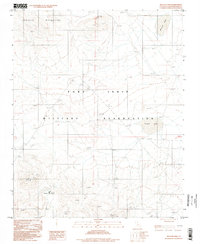
1996 Map of Nelson Lake
USGS Topo · Published 1998About this map
The Fort Irwin Military Reservation dominates this desert landscape in San Bernardino County, where the southern reaches of the Granite Mountains meet broad, arid basins. High-altitude telecommunications infrastructure is a defining characteristic of the terrain, marked by several prominent Radio Towers and a specific Radio Facility Call 3986T. The map also captures the isolated Pioneer site and the nearby Pioneer Tank, indicating small pockets of development or staging areas within the vast military training grounds.
Find a feature on this map
11 named features on this map. Tap any name to fly to it.
Don’t see what you’re looking for? This feature index may not catch every label — zoom into the map to look around manually.
Map Details
Editions of this 1996 Nelson Lake Map
This is the sole edition of this map. No revisions or reprints were ever made.
Other maps of this area

1933 · Avawatz Mountains
USGS Topo · 1:250,000

1947 · Trona
USGS Topo · 1:250,000

1948 · Trona
USGS Topo · 1:250,000

1948 · Quail Mountains
USGS Topo · 1:62,500

1948 · Leach Lake
USGS Topo · 1:62,500

1948 · Goldstone Lake
USGS Topo · 1:62,500

1948 · Tiefort Mountains
USGS Topo · 1:62,500

1951 · Goldstone Lake
USGS Topo · 1:62,500

1951 · Tiefort Mountains
USGS Topo · 1:62,500

1951 · Quail Mountains
USGS Topo · 1:62,500