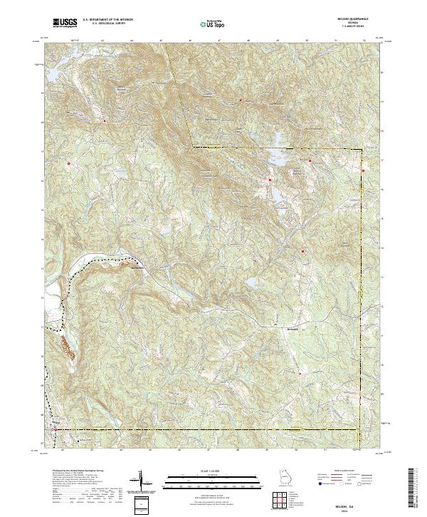
2024 Map of Nelson
USGS Topo · Published 2024About this map
Mt Oglethorpe and Hendrix Mountain dominate this northern Georgia landscape at the junction of Cherokee, Pickens, and Dawson counties. The settlement of Nelson sits at the southwestern edge, anchored by the historical Bethesda Cem, while Marblehill and Holcomb serve as key crossroads for the surrounding area. The terrain is defined by a dense network of ridges such as Bethel Ridge and Pettit Ridge, separated by significant water bodies like Lake Petit and Dubose Lake. The mapping reveals a historical transportation framework including Old Federal Rd and Lawson Federal Rd, which weave through the gaps and valleys. Major watercourses like Long Swamp Creek and Amicalola Creek carve through the foothills, indicating a landscape shaped by both its mountain geography and long-standing transit routes between rural communities.
Find a feature on this map
56 named features on this map. Tap any name to fly to it.
Don’t see what you’re looking for? This feature index may not catch every label — zoom into the map to look around manually.
Map Details
Editions of this 2024 Nelson Map
This is the sole edition of this map. No revisions or reprints were ever made.
Other maps of this area

1888 · Ellijay
USGS Topo · 1:125,000

1890 · Suwanee
USGS Topo · 1:125,000

1892 · Ellijay
USGS Topo · 1:125,000

1894 · Suwanee
USGS Topo · 1:125,000

1898 · Ellijay
USGS Topo · 1:125,000

1911 · Ellijay
USGS Topo · 1:125,000

1926 · Tate
USGS Topo · 1:62,500

1928 · Tate
USGS Topo · 1:62,500

1955 · Rome
USGS Topo · 1:250,000

1958 · Rome
USGS Topo · 1:250,000