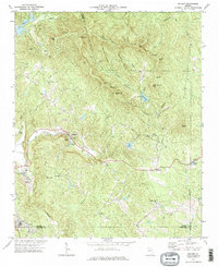
1972 Map of Nelson
USGS Topo · Published 1975About this map
The marble industry of the Georgia mountains is clearly visible in this 1970s record, centered on the heavy extraction sites surrounding Marblehill and the city of Nelson. Numerous Quarries dot the landscape near East Br, where a Settling Pond and Water Tank suggest the industrial scale of the operations along the Pickens and Cherokee county lines. This topography reveals a region defined by both its resource wealth and its rural community structure, with small settlements like Holcomb and family-named ridges providing a backdrop to the industrial works.
Find a feature on this map
53 named features on this map. Tap any name to fly to it.
Don’t see what you’re looking for? This feature index may not catch every label — zoom into the map to look around manually.
Map Details
Editions of this 1972 Nelson Map
2 editions found
Other maps of this area

1888 · Ellijay
USGS Topo · 1:125,000

1890 · Suwanee
USGS Topo · 1:125,000

1892 · Ellijay
USGS Topo · 1:125,000

1894 · Suwanee
USGS Topo · 1:125,000

1898 · Ellijay
USGS Topo · 1:125,000

1911 · Ellijay
USGS Topo · 1:125,000

1926 · Tate
USGS Topo · 1:62,500

1928 · Tate
USGS Topo · 1:62,500

1955 · Rome
USGS Topo · 1:250,000

1958 · Rome
USGS Topo · 1:250,000