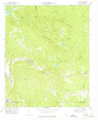
1972 Map of Nelson
USGS Topo · Published 1975About this map
The marble industrial landscape of Pickens and Cherokee counties is prominently displayed in this 1970s survey, centered on the community of Marblehill. Numerous Quarries and a Settling Pond indicate the active extraction economy of the era, while the Tate Highway provides the primary transit corridor through the undulating terrain. To the north, Mt Oglethorpe and Sanderlin Mtn anchor a ridge system that defines the local watershed, feeding numerous water bodies including Tamarack Lake and Sconti Lake. Historical social centers are preserved through the mapping of country churches such as Long Swamp Ch, Fourmile Ch, and Bethesda Ch. The intersection of Pickens, Cherokee, and Dawson counties creates a complex boundary system near Holcomb, where the landscape transitions into the drainages of Yellow Creek and Amicalola Creek.
Find a feature on this map
54 named features on this map. Tap any name to fly to it.
Don’t see what you’re looking for? This feature index may not catch every label — zoom into the map to look around manually.
Map Details
Editions of this 1972 Nelson Map
2 editions found
Other maps of this area

1888 · Ellijay
USGS Topo · 1:125,000

1890 · Suwanee
USGS Topo · 1:125,000

1892 · Ellijay
USGS Topo · 1:125,000

1894 · Suwanee
USGS Topo · 1:125,000

1898 · Ellijay
USGS Topo · 1:125,000

1911 · Ellijay
USGS Topo · 1:125,000

1926 · Tate
USGS Topo · 1:62,500

1928 · Tate
USGS Topo · 1:62,500

1955 · Rome
USGS Topo · 1:250,000

1958 · Rome
USGS Topo · 1:250,000