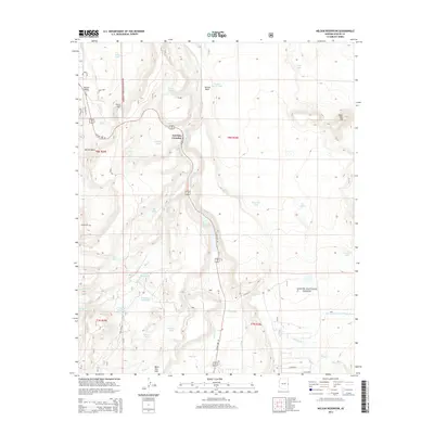
2014 Map of Nelson Reservoir
USGS Topo · Published 2014About this map
Nutrioso Cr flows through this high-altitude landscape of eastern Arizona, carving a path between the northern reaches of the Apache National Forest and the open expanses of Round Valley. This 2014 survey captures a region defined by its managed water resources, including the prominent Nelson Reservoir and numerous livestock and irrigation impoundments like Glen Livet Reservoir and Basin Tank. The presence of Butler Cem near the western edge and the named crossing at Correjo Crossing provide essential markers for genealogical research and local history within this ranching and forest landscape.
Find a feature on this map
48 named features on this map. Tap any name to fly to it.
Don’t see what you’re looking for? This feature index may not catch every label — zoom into the map to look around manually.
Map Details
Editions of this 2014 Nelson Reservoir Map
This is the sole edition of this map. No revisions or reprints were ever made.
Other maps of this area

1886 · St Johns
USGS Topo · 1:250,000

1892 · St Johns
USGS Topo · 1:250,000

1922 · Nutrioso
USGS Topo · 1:125,000

1954 · Clifton
USGS Topo · 1:250,000

1954 · Saint Johns
USGS Topo · 1:250,000

1957 · Clifton
USGS Topo · 1:250,000

1957 · Saint Johns
USGS Topo · 1:250,000

1958 · Clifton
USGS Topo · 1:250,000

1958 · Saint Johns
USGS Topo · 1:250,000

1958 · Alpine
USGS Topo · 1:62,500