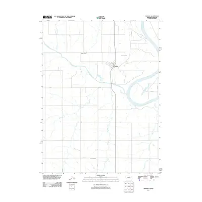
2011 Map of Nemaha
USGS Topo · Published 2011About this map
The confluence of the Little Nemaha River and the winding Missouri River anchor this landscape along the Nebraska-Missouri border. The settlement of Nemaha serves as the central hub of activity, featuring the Nemaha Post Office and nearby Nemaha Cemetery. This region is defined by its network of watercourses, including the long paths of Whisky Run and Jarvis Creek that drain the agricultural uplands.
Find a feature on this map
18 named features on this map. Tap any name to fly to it.
Don’t see what you’re looking for? This feature index may not catch every label — zoom into the map to look around manually.
Map Details
Editions of this 2011 Nemaha Map
This is the sole edition of this map. No revisions or reprints were ever made.
Other maps of this area

1915 · Falls City
USGS Topo · 1:62,500

1915 · Nemaha
USGS Topo · 1:62,500

1915 · Howe
USGS Topo · 1:62,500

1916 · Humboldt
USGS Topo · 1:62,500

1939 · Nemaha
USGS Topo · 1:62,500

1949 · Nemaha
USGS Topo · 1:62,500

1955 · Nebraska City
USGS Topo · 1:250,000

1957 · Nebraska City
USGS Topo · 1:250,000

1958 · Nebraska City
USGS Topo · 1:250,000
1965 · Dawson
USGS Topo · 1:24,000