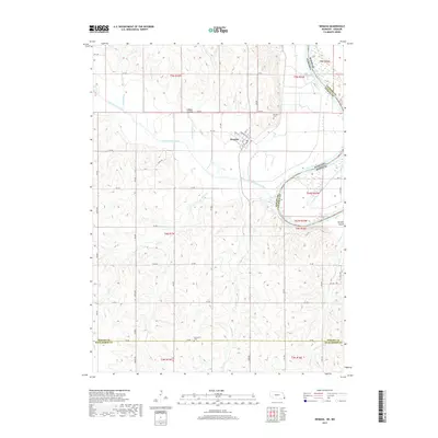
2017 Map of Nemaha
USGS Topo · Published 2017About this map
Nemaha sits at the convergence of several drainages and a well-defined grid of section roads in this 2017 survey of southeast Nebraska. The town layout is clearly delineated by streets like Main St, Washington St, and 1st St, with the Nemaha Cem positioned just north of the residential core. The landscape is deeply carved by the Little Nemaha River and its various tributaries, including Whisky Run and Happy Hollow Cr.
Find a feature on this map
50 named features on this map. Tap any name to fly to it.
Don’t see what you’re looking for? This feature index may not catch every label — zoom into the map to look around manually.
Map Details
Editions of this 2017 Nemaha Map
This is the sole edition of this map. No revisions or reprints were ever made.
Other maps of this area

1915 · Falls City
USGS Topo · 1:62,500

1915 · Nemaha
USGS Topo · 1:62,500

1915 · Howe
USGS Topo · 1:62,500

1916 · Humboldt
USGS Topo · 1:62,500

1939 · Nemaha
USGS Topo · 1:62,500

1949 · Nemaha
USGS Topo · 1:62,500

1955 · Nebraska City
USGS Topo · 1:250,000

1957 · Nebraska City
USGS Topo · 1:250,000

1958 · Nebraska City
USGS Topo · 1:250,000
1965 · Dawson
USGS Topo · 1:24,000