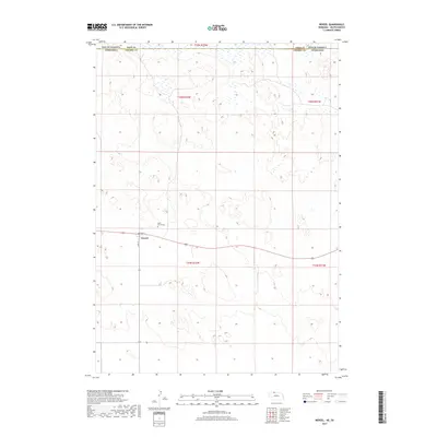
2017 Map of Nenzel
USGS Topo · Published 2017About this map
Nenzel occupies a distinct position in the Sandhills of northern Cherry County, sitting just south of the border between Nebraska and South Dakota. This landscape is defined by the transition from the high plains into the undulating sand dune formations typical of the region. The small settlement is clustered around the intersection of Main St and Front St, reflecting a compact grid common to rural rail and highway outposts. Just to the north, Saint Marys Cem serves as a primary genealogical landmark for the community. The topography is marked by numerous small wetlands and basins throughout the northern sections, particularly across the boundary line between Todd County and Cherry County.
Find a feature on this map
10 named features on this map. Tap any name to fly to it.
Don’t see what you’re looking for? This feature index may not catch every label — zoom into the map to look around manually.
Map Details
Editions of this 2017 Nenzel Map
This is the sole edition of this map. No revisions or reprints were ever made.
Other maps of this area

1950 · Kilgore
USGS Topo · 1:62,500

1950 · Cody
USGS Topo · 1:62,500

1955 · Martin
USGS Topo · 1:250,000

1957 · Valentine
USGS Topo · 1:250,000

1958 · Martin
USGS Topo · 1:250,000

1959 · Valentine
USGS Topo · 1:250,000

1969 · Spring Creek SW
USGS Topo · 1:24,000

1969 · Spring Creek
USGS Topo · 1:24,000

1969 · St. Francis SW
USGS Topo · 1:24,000

1982 · Mission
USGS Topo · 1:100,000