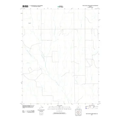
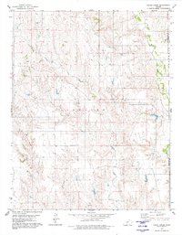
2009 Map of Nescatunga Creek North
USGS Topo · Published 2009About this map
Nescatunga Cemetery stands as a primary landmark in this sparsely settled corner of Comanche County, marking a site of genealogical importance in the prairie landscape. The area is defined by the complex drainage system of Nescatunga Creek and its major tributaries, including the West Branch Nescatunga Creek and East Branch Nescatunga Creek. These waterways, along with others like Sand Creek and Wildcat Creek, have shaped the rural infrastructure of the region, where roads follow the sections and creek beds. The drainage patterns shown here reflect the natural topography of the High Plains, where seasonal watercourses like Cave Creek dictate the layout of ranching and agricultural tracts. This 2009 survey preserves the exact location of family burial grounds and the orientation of local water-rights features at the start of the 21st century.
Find a feature on this map
7 named features on this map. Tap any name to fly to it.
Don’t see what you’re looking for? This feature index may not catch every label — zoom into the map to look around manually.
Map Details
Editions of this 2009 Nescatunga Creek North Map
This is the sole edition of this map. No revisions or reprints were ever made.
Other maps of this area

1892 · Coldwater
USGS Topo · 1:125,000

1955 · Pratt
USGS Topo · 1:250,000

1959 · Pratt
USGS Topo · 1:250,000

1968 · Wilmore SE
USGS Topo · 1:24,000

1979 · Coldwater
USGS Topo · 1:24,000

1979 · Protection NE
USGS Topo · 1:24,000
1979 · Nescatunga Creek South
USGS Topo · 1:24,000
1980 · Nescatunga Creek North
USGS Topo · 1:24,000
1980 · Wilmore
USGS Topo · 1:24,000
1980 · Indian Creek
USGS Topo · 1:24,000