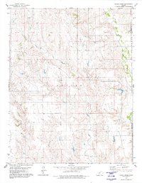
1980 Map of Indian Creek
USGS Topo · Published 1980About this map
Indian Creek and its many tributaries, including Owl Creek and Wildcat Creek, carve a detailed drainage network across this section of south-central Kansas. This 1980 survey captures the region during a period of active energy extraction, prominently featuring an expansive Gas Field and individual Oil Wells across the townships of Coldwater and Deerhead. The landscape is defined by the transition between the rolling uplands and the river bottoms of Mule Creek along the eastern boundary. This map reveals the rural infrastructure of the era, from the placement of isolated Drill Holes to the section-line roads that organize the cattle country and energy patches of Comanche and Barber Counties.
Find a feature on this map
13 named features on this map. Tap any name to fly to it.
Don’t see what you’re looking for? This feature index may not catch every label — zoom into the map to look around manually.
Map Details
Editions of this 1980 Indian Creek Map
This is the sole edition of this map. No revisions or reprints were ever made.
Other maps of this area

1891 · Medicine Lodge
USGS Topo · 1:125,000

1892 · Coldwater
USGS Topo · 1:125,000

1893 · Medicine Lodge
USGS Topo · 1:125,000

1955 · Pratt
USGS Topo · 1:250,000

1959 · Pratt
USGS Topo · 1:250,000

1968 · Sun City SW
USGS Topo · 1:24,000

1968 · Wilmore SE
USGS Topo · 1:24,000
1973 · Deerhead
USGS Topo · 1:24,000
1973 · Aetna
USGS Topo · 1:24,000
1979 · Nescatunga Creek South
USGS Topo · 1:24,000