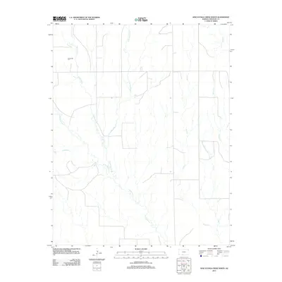
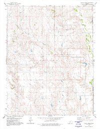
2012 Map of Nescatunga Creek North
USGS Topo · Published 2012About this map
Nescatunga Cem stands as a focal point for local history in this rural Comanche County landscape, situated near the headwaters of the regional drainage system. The terrain is defined by a dense network of intermittent streams and coulees that feed into Nescatunga Cr and its principal tributaries, the W Br Nescatunga Cr and E Br Nescatunga Cr. This area of Kansas is characterized by its agricultural grid, where section lines dictate the road network across the open plains.
Find a feature on this map
8 named features on this map. Tap any name to fly to it.
Don’t see what you’re looking for? This feature index may not catch every label — zoom into the map to look around manually.
Map Details
Editions of this 2012 Nescatunga Creek North Map
This is the sole edition of this map. No revisions or reprints were ever made.
Other maps of this area

1892 · Coldwater
USGS Topo · 1:125,000

1955 · Pratt
USGS Topo · 1:250,000

1959 · Pratt
USGS Topo · 1:250,000

1968 · Wilmore SE
USGS Topo · 1:24,000

1979 · Coldwater
USGS Topo · 1:24,000

1979 · Protection NE
USGS Topo · 1:24,000
1979 · Nescatunga Creek South
USGS Topo · 1:24,000
1980 · Nescatunga Creek North
USGS Topo · 1:24,000
1980 · Wilmore
USGS Topo · 1:24,000
1980 · Indian Creek
USGS Topo · 1:24,000