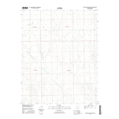
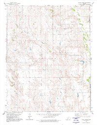
2015 Map of Nescatunga Creek North
USGS Topo · Published 2015About this map
Nescatunga Creek and its complex network of tributaries define this Comanche County landscape, providing a detailed look at the drainage patterns of south-central Kansas. The area is characterized by the branching paths of the East Branch Nescatunga Creek and the West Branch Nescatunga Creek, which converge as they flow through the township boundaries of t32s r18w and t33s r17w. Genealogists and local historians will find the Nescatunga Cemetery in the northwestern quadrant, a quiet marker of the community's roots near the waterway that shares its name. The terrain is further etched by numerous smaller streams including Sand Creek, Wildcat Creek, and Cave Creek, while a rigid grid of rural routes such as CM RD 19 and Ave L provides the primary infrastructure for the region's agricultural holdings.
Find a feature on this map
21 named features on this map. Tap any name to fly to it.
Don’t see what you’re looking for? This feature index may not catch every label — zoom into the map to look around manually.
Map Details
Editions of this 2015 Nescatunga Creek North Map
This is the sole edition of this map. No revisions or reprints were ever made.
Other maps of this area

1892 · Coldwater
USGS Topo · 1:125,000

1955 · Pratt
USGS Topo · 1:250,000

1959 · Pratt
USGS Topo · 1:250,000

1968 · Wilmore SE
USGS Topo · 1:24,000

1979 · Coldwater
USGS Topo · 1:24,000

1979 · Protection NE
USGS Topo · 1:24,000
1979 · Nescatunga Creek South
USGS Topo · 1:24,000
1980 · Nescatunga Creek North
USGS Topo · 1:24,000
1980 · Wilmore
USGS Topo · 1:24,000
1980 · Indian Creek
USGS Topo · 1:24,000