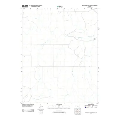
2009 Map of Nescatunga Creek South
USGS Topo · Published 2009About this map
The Salt Fork Arkansas River flows across this southern portion of Comanche County, defining a landscape of riparian drainage and prairie breaks. This 2009 survey highlights the convergence of several major tributaries, including Nescatunga Creek and Mustang Creek, which carve distinct paths through the local topography. The presence of Cristy Canyon in the eastern section of the map indicates the more dramatic relief where upland terrain meets the river valley. Sparse road networks and the sprawling reaches of Cottonwood Creek characterize this region, illustrating the rural character of the Kansas borderlands. For those studying the hydrology and land divisions of the High Plains, this map captures the complex system of creeks that feed into the larger Arkansas River drainage system.
Find a feature on this map
5 named features on this map. Tap any name to fly to it.
Don’t see what you’re looking for? This feature index may not catch every label — zoom into the map to look around manually.
Map Details
Editions of this 2009 Nescatunga Creek South Map
This is the sole edition of this map. No revisions or reprints were ever made.
Other maps of this area

1892 · Coldwater
USGS Topo · 1:125,000

1955 · Woodward
USGS Topo · 1:250,000

1955 · Pratt
USGS Topo · 1:250,000

1958 · Woodward
USGS Topo · 1:250,000

1959 · Pratt
USGS Topo · 1:250,000

1970 · Lookout
USGS Topo · 1:24,000

1970 · Freedom NE
USGS Topo · 1:24,000

1970 · Freedom NW
USGS Topo · 1:24,000

1979 · Protection NE
USGS Topo · 1:24,000
1979 · Nescatunga Creek South
USGS Topo · 1:24,000