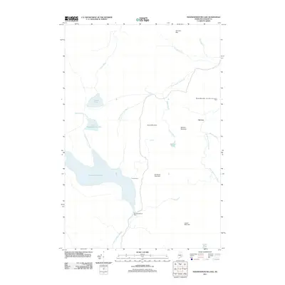
2011 Map of Nesowadnehunk Lake
USGS Topo · Published 2011About this map
Nesowadnehunk Lake dominates this northern Maine landscape, its waters regulated by the Nesowadnehunk Dam at the southern outflow into Nesowadnehunk Stream. The area's character is defined by the high-elevation terrain of the Maine woods, where Camp Phoenix sits on the lake's eastern shore and the remote outpost of McCarty provides a human presence among the peaks. A network of waterways including North Branch Trout Brook, South Branch Trout Brook, and Dwelley Brook drain the surrounding mountains.
Find a feature on this map
23 named features on this map. Tap any name to fly to it.
Don’t see what you’re looking for? This feature index may not catch every label — zoom into the map to look around manually.
Map Details
Editions of this 2011 Nesowadnehunk Lake Map
This is the sole edition of this map. No revisions or reprints were ever made.
Other maps of this area

1927 · Katahdin
USGS Topo · 1:48,000

1930 · Katahdin
USGS Topo · 1:62,500

1949 · Katahdin
USGS Topo · 1:62,500

1953 · Telos Lake
USGS Topo · 1:62,500

1954 · Harrington Lake
USGS Topo · 1:62,500

1954 · Presque Isle
USGS Topo · 1:250,000

1954 · Millinocket
USGS Topo · 1:250,000

1955 · Traveler Mountain
USGS Topo · 1:62,500

1957 · Telos Lake
USGS Topo · 1:62,500

1958 · Presque Isle
USGS Topo · 1:250,000