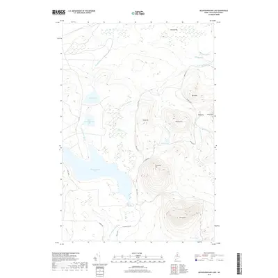
2018 Map of Nesowadnehunk Lake
USGS Topo · Published 2018About this map
Nesowadnehunk Lake and its surrounding peaks dominate this wilderness section of Piscataquis County, captured during a 2018 survey. The landscape is defined by its complex hydrography, where Nesowadnehunk Stream and Thissell Brook navigate the drainages between high elevations such as Center Mtn and McCarty Mtn. The area is remarkably unpopulated, with only the settlement of McCarty providing a named point of human habitation among the sprawling wetlands of Kennedy Bog and Black Spruce Bog.
Find a feature on this map
28 named features on this map. Tap any name to fly to it.
Don’t see what you’re looking for? This feature index may not catch every label — zoom into the map to look around manually.
Map Details
Editions of this 2018 Nesowadnehunk Lake Map
This is the sole edition of this map. No revisions or reprints were ever made.
Other maps of this area

1927 · Katahdin
USGS Topo · 1:48,000

1930 · Katahdin
USGS Topo · 1:62,500

1949 · Katahdin
USGS Topo · 1:62,500

1953 · Telos Lake
USGS Topo · 1:62,500

1954 · Harrington Lake
USGS Topo · 1:62,500

1954 · Presque Isle
USGS Topo · 1:250,000

1954 · Millinocket
USGS Topo · 1:250,000

1955 · Traveler Mountain
USGS Topo · 1:62,500

1957 · Telos Lake
USGS Topo · 1:62,500

1958 · Presque Isle
USGS Topo · 1:250,000