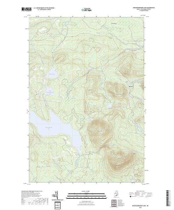
2024 Map of Nesowadnehunk Lake
USGS Topo · Published 2024About this map
McCarty sits at the nexus of logging roads and high peaks in this remote section of the Maine north woods. The landscape is dominated by the massive profile of Center Mtn and Strickland Mtn, which overlook the expansive Nesowadnehunk Lake. The presence of Park Tote Rd, Turnpike Rd, and Nesowadnehunk Rd indicates a geography defined by historic transport routes that once supported the regional timber industry. These roads thread through a complex hydrological network of bogs and brooks, including Kennedy Bog and Black Spruce Bog. Smaller water bodies like Little Nesowadnehunk Lake and Thissell Pond are tucked into the drainages between granite heights like Morse Mtn and McCarty Mtn, offering a detailed view of the drainage patterns of Nesowadnehunk Stream before it joins the larger river systems to the south.
Find a feature on this map
28 named features on this map. Tap any name to fly to it.
Don’t see what you’re looking for? This feature index may not catch every label — zoom into the map to look around manually.
Map Details
Editions of this 2024 Nesowadnehunk Lake Map
This is the sole edition of this map. No revisions or reprints were ever made.
Other maps of this area

1927 · Katahdin
USGS Topo · 1:48,000

1930 · Katahdin
USGS Topo · 1:62,500

1949 · Katahdin
USGS Topo · 1:62,500

1953 · Telos Lake
USGS Topo · 1:62,500

1954 · Harrington Lake
USGS Topo · 1:62,500

1954 · Presque Isle
USGS Topo · 1:250,000

1954 · Millinocket
USGS Topo · 1:250,000

1955 · Traveler Mountain
USGS Topo · 1:62,500

1957 · Telos Lake
USGS Topo · 1:62,500

1958 · Presque Isle
USGS Topo · 1:250,000