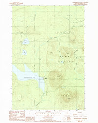
1988 Map of Nesowadnehunk Lake
USGS Topo · Published 1988About this map
Baxter State Park dominates this landscape in the late 1980s, preserving a wilderness of high peaks and interconnected waterways. The terrain is defined by the significant elevations of Morse Mountain, McCarty Mountain, and Strickland Mountain, which overlook a network of glacial features including Black Spruce Bog and Kennedy Bog. Along the shore of Nesowadnehunk Lake, the presence of Camp Phoenix and a Public Boat Landing indicate the area's role as a destination for backcountry recreation and angling. The map reveals the hydrology of the North Woods, where Thissell Brook and the North Branch Trout Brook carve through the forested townships of T 5 R 11 W E L S and Nesourdnahunk. Private roads and trails provide the only access to remote interior waters like Thissell Pond and Dwelley Pond, reflecting the managed nature of this timberland and parkland border.
Find a feature on this map
32 named features on this map. Tap any name to fly to it.
Don’t see what you’re looking for? This feature index may not catch every label — zoom into the map to look around manually.
Map Details
Editions of this 1988 Nesowadnehunk Lake Map
This is the sole edition of this map. No revisions or reprints were ever made.
Other maps of this area

1927 · Katahdin
USGS Topo · 1:48,000

1930 · Katahdin
USGS Topo · 1:62,500

1949 · Katahdin
USGS Topo · 1:62,500

1953 · Telos Lake
USGS Topo · 1:62,500

1954 · Harrington Lake
USGS Topo · 1:62,500

1954 · Presque Isle
USGS Topo · 1:250,000

1954 · Millinocket
USGS Topo · 1:250,000

1955 · Traveler Mountain
USGS Topo · 1:62,500

1957 · Telos Lake
USGS Topo · 1:62,500

1958 · Presque Isle
USGS Topo · 1:250,000