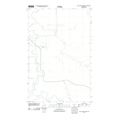
2010 Map of Nett Lake River West
USGS Topo · Published 2010About this map
Little Fork River and Nett Lake River define the winding hydrology of this Koochiching County landscape. The two waterways converge in the northern portion of the quadrangle, creating a complex drainage network typical of the northern Minnesota forest and wetlands. The human footprint is sparse, represented primarily by a few rural routes such as County Hwy-8 and Promersberger Rd which cut through the dense vegetation. Genealogists and local historians will find the Dentaybow Cemetery located along the highway, serving as a primary point of historical reference for the area's residents. Downstream on the Little Fork, the presence of Deadmans Rapids suggests the challenges early river travel may have faced before more modern roads like River Rd provided consistent overland access through this isolated river valley.
Find a feature on this map
12 named features on this map. Tap any name to fly to it.
Don’t see what you’re looking for? This feature index may not catch every label — zoom into the map to look around manually.
Map Details
Editions of this 2010 Nett Lake River West Map
This is the sole edition of this map. No revisions or reprints were ever made.
Other maps of this area

1919 · Happy Land
USGS Topo · 1:62,500

1919 · M
USGS Topo · 1:62,500

1954 · International Falls
USGS Topo · 1:250,000

1957 · International Falls
USGS Topo · 1:250,000

1958 · International Falls
USGS Topo · 1:250,000

1969 · Ericsburg SE
USGS Topo · 1:24,000

1969 · Ericsburg SW
USGS Topo · 1:24,000

1970 · Johnson Landing SE
USGS Topo · 1:24,000

1970 · Littlefork SE
USGS Topo · 1:24,000

1970 · Nett Lake River SE
USGS Topo · 1:24,000