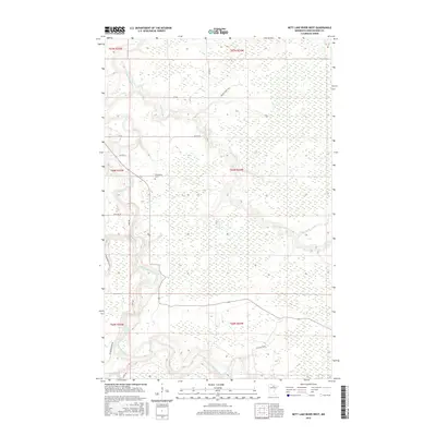
2016 Map of Nett Lake River West
USGS Topo · Published 2016About this map
Little Fork River meanders through the dense wetlands of northern Koochiching County, joined by the Nett Lake River as it flows toward the northwest. This landscape is defined by its extensive marshy terrain and a network of rural timber and forest roads. Local history is anchored at the Dentaybow Cem, which sits near the riverbanks and provides a point of reference for genealogists researching families from this remote area. Further south along the waterway, the Deadman Rapids marks a distinct change in the river's character. The map illustrates a transition between large sections of the public land survey system, including townships T66N R24W and T65N R25W, showing how isolated road systems like Promberger Rd and Parson Forest Rd navigate the boggy Northwoods environment.
Find a feature on this map
19 named features on this map. Tap any name to fly to it.
Don’t see what you’re looking for? This feature index may not catch every label — zoom into the map to look around manually.
Map Details
Editions of this 2016 Nett Lake River West Map
This is the sole edition of this map. No revisions or reprints were ever made.
Other maps of this area

1919 · Happy Land
USGS Topo · 1:62,500

1919 · M
USGS Topo · 1:62,500

1954 · International Falls
USGS Topo · 1:250,000

1957 · International Falls
USGS Topo · 1:250,000

1958 · International Falls
USGS Topo · 1:250,000

1969 · Ericsburg SE
USGS Topo · 1:24,000

1969 · Ericsburg SW
USGS Topo · 1:24,000

1970 · Johnson Landing SE
USGS Topo · 1:24,000

1970 · Littlefork SE
USGS Topo · 1:24,000

1970 · Nett Lake River SE
USGS Topo · 1:24,000