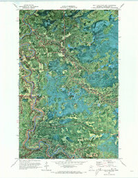
1970 Map of Nett Lake River West
USGS Topo · Published 1973About this map
The confluence of the Nett River and the meandering Little Fork River anchor this 1970 orthophotograph of northern Minnesota. This specialized map combines the visual texture of an aerial photograph with topographic precision, revealing the dense vegetation and hydrography within the Koochiching State Forest. The winding riverbanks and numerous wetlands define the landscape, interrupted only by subtle human imprints such as a Gravel Pit and segments of a Winter Trail. Navigation through this water-rich territory is marked by the distinctive Deadmans Rapids along the river's path. Unlike standard line-drawn maps, this orthophoto provides a direct look at the forest canopy and river morphology as they existed just before the turn of the decade, making it an invaluable resource for environmental historians and those studying the natural progression of the state's northern wilderness.
Find a feature on this map
7 named features on this map. Tap any name to fly to it.
Don’t see what you’re looking for? This feature index may not catch every label — zoom into the map to look around manually.
Map Details
Editions of this 1970 Nett Lake River West Map
This is the sole edition of this map. No revisions or reprints were ever made.
Other maps of this area

1919 · Happy Land
USGS Topo · 1:62,500

1919 · M
USGS Topo · 1:62,500

1954 · International Falls
USGS Topo · 1:250,000

1957 · International Falls
USGS Topo · 1:250,000

1958 · International Falls
USGS Topo · 1:250,000

1969 · Ericsburg SE
USGS Topo · 1:24,000

1969 · Ericsburg SW
USGS Topo · 1:24,000

1970 · Johnson Landing SE
USGS Topo · 1:24,000

1970 · Littlefork SE
USGS Topo · 1:24,000

1970 · Nett Lake River SE
USGS Topo · 1:24,000