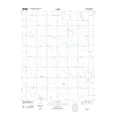
2012 Map of Neutral
USGS Topo · Published 2012About this map
Neutral and the surrounding Cherokee County landscape are defined by a regular grid of section roads and small watercourses like Willow Cr and Bitter Cr. The area around Cravensville and Captain reflects the enduring agricultural and rural layout of southeastern Kansas, where family and community heritage is preserved in numerous burial grounds, including Beasley Cem, Usrey Cem, and Pleasant View Cem. The southern portion of the sheet features the prominent Blue Mound and the Walter A Swalley Airpark, while the northern edge is marked by Brush Cr as it winds toward the Brush Creek Cem. This 2012 survey illustrates the transition from open farmland to the outskirts of more established settlements, providing a clear record of land use and local geography in the early 21st century.
Find a feature on this map
58 named features on this map. Tap any name to fly to it.
Don’t see what you’re looking for? This feature index may not catch every label — zoom into the map to look around manually.
Map Details
Editions of this 2012 Neutral Map
This is the sole edition of this map. No revisions or reprints were ever made.
Other maps of this area

1886 · Joplin
USGS Topo · 1:125,000

1894 · Joplin
USGS Topo · 1:125,000

1907 · Wyandotte
USGS Topo · 1:125,000

1909 · Wyandotte
USGS Topo · 1:125,000

1918 · Columbus
USGS Topo · 1:62,500

1947 · Joplin
USGS Topo · 1:250,000

1949 · Joplin
USGS Topo · 1:250,000

1954 · Tulsa
USGS Topo · 1:250,000

1954 · Joplin
USGS Topo · 1:250,000

1958 · Joplin
USGS Topo · 1:250,000