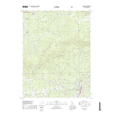
2018 Map of Nevada City
USGS Topo · Published 2018About this map
Nevada City sits at the heart of this survey, where the concentrated street grid reflects its enduring status as a regional hub. To the north, the landscape is defined by the high elevations of the San Juan Ridge and Montezuma Ridge, which separate the drainage of Shady Cr from the S Yuba River canyon. The presence of several smaller settlements such as North San Juan, Cherokee, and Sebastopol illustrates the historical distribution of communities across the gold-bearing ridges.
Find a feature on this map
95 named features on this map. Tap any name to fly to it.
Don’t see what you’re looking for? This feature index may not catch every label — zoom into the map to look around manually.
Map Details
Editions of this 2018 Nevada City Map
This is the sole edition of this map. No revisions or reprints were ever made.
Other maps of this area

1888 · Smartsville
USGS Topo · 1:125,000

1891 · Colfax
USGS Topo · 1:125,000

1891 · Smartsville
USGS Topo · 1:125,000

1892 · Smartsville
USGS Topo · 1:125,000

1892 · Colfax
USGS Topo · 1:125,000

1894 · Colfax
USGS Topo · 1:125,000

1894 · Smartsville
USGS Topo · 1:125,000

1895 · Smartsville
USGS Topo · 1:125,000

1898 · Colfax
USGS Topo · 1:125,000

1900 · Colfax
USGS Topo · 1:125,000