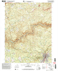
2000 Map of Nevada City
USGS Topo · Published 2003About this map
Nevada City sits at the southern edge of this landscape, where the Sierra foothills are carved by the dramatic drainage of the South Yuba River. The map reveals a complex history of resource extraction, most notably at the Cherokee Diggings Hydraulic Mine and Columbia Diggings Mine, which left permanent marks on the terrain near Cherokee. These hydraulic mining sites, along with several gravel pits and smaller mines, speak to the gold-rush era heritage that shaped the region's economy and topography.
Find a feature on this map
66 named features on this map. Tap any name to fly to it.
Don’t see what you’re looking for? This feature index may not catch every label — zoom into the map to look around manually.
Map Details
Editions of this 2000 Nevada City Map
This is the sole edition of this map. No revisions or reprints were ever made.
Other maps of this area

1888 · Smartsville
USGS Topo · 1:125,000

1891 · Colfax
USGS Topo · 1:125,000

1891 · Smartsville
USGS Topo · 1:125,000

1892 · Smartsville
USGS Topo · 1:125,000

1892 · Colfax
USGS Topo · 1:125,000

1894 · Colfax
USGS Topo · 1:125,000

1894 · Smartsville
USGS Topo · 1:125,000

1895 · Smartsville
USGS Topo · 1:125,000

1898 · Colfax
USGS Topo · 1:125,000

1900 · Colfax
USGS Topo · 1:125,000