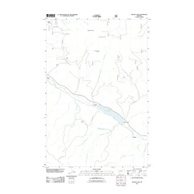
2011 Map of Nevada Lake
USGS Topo · Published 2011About this map
Ogden Mountain dominates the northern skyline of this Montana landscape, where the waters of Nevada Creek are harnessed by the Nevada Creek Dam to form Nevada Lake. This 2011 survey records a region defined by its historic mineral extraction and high-country meadows. The map identifies several specific mining operations, including the Higgins Mine, Blackfoot Mine, and various section-level claims like the SW NW Section 26 Mine. To the southeast, the small settlement of Mannix sits along the creek below Buffalo Gulch, while high-elevation features like Cottonwood Mdw and Braziel Lake underscore the area's wilderness character. The intricate drainage network of Chicken Creek, Sauerkraut Creek, and West Fork Indian Creek highlights the complex watershed that feeds the Nevada Creek basin.
Find a feature on this map
33 named features on this map. Tap any name to fly to it.
Don’t see what you’re looking for? This feature index may not catch every label — zoom into the map to look around manually.
Map Details
Editions of this 2011 Nevada Lake Map
This is the sole edition of this map. No revisions or reprints were ever made.
Other maps of this area

1889 · Helena
USGS Topo · 1:250,000

1893 · Helena
USGS Topo · 1:250,000

1899 · Helena
USGS Topo · 1:250,000

1903 · Helena
USGS Topo · 1:250,000

1947 · Butte
USGS Topo · 1:250,000

1958 · Butte
USGS Topo · 1:250,000

1958 · Avon
USGS Topo · 1:62,500

1958 · Garrison
USGS Topo · 1:62,500

1960 · Butte
USGS Topo · 1:250,000

1962 · Butte
USGS Topo · 1:250,000