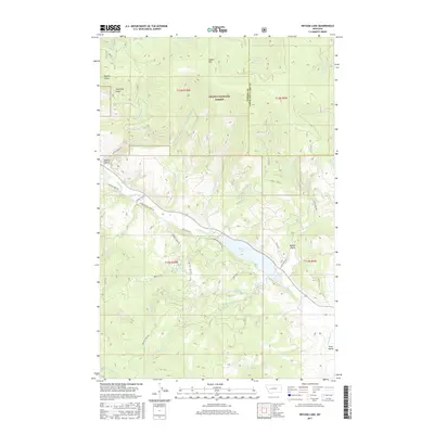
2017 Map of Nevada Lake
USGS Topo · Published 2017About this map
Nevada Lake serves as a central hub for the drainage networks in this portion of the Helena National Forest, situated where the Nevada Creek basin meets the northern reaches of the Avon Valley. The terrain is defined by a series of gulches and mountain peaks, including Ogden Mtn and Rossin Gulch, which overlook a complex web of rural ranch roads and forest routes. The map detail highlights the hydrological importance of the area, featuring named water bodies such as Braziel Lake and numerous tributaries like Sauerkraut Creek and Indian Creek. This 2017 survey reflects the modern management of public and private lands near the boundary of Powell and Lewis and Clark counties, where legacy ranching names like Nevada Creek Road and Braziel Creek Road trace the historical movement through these high mountain valleys.
Find a feature on this map
45 named features on this map. Tap any name to fly to it.
Don’t see what you’re looking for? This feature index may not catch every label — zoom into the map to look around manually.
Map Details
Editions of this 2017 Nevada Lake Map
This is the sole edition of this map. No revisions or reprints were ever made.
Other maps of this area

1889 · Helena
USGS Topo · 1:250,000

1893 · Helena
USGS Topo · 1:250,000

1899 · Helena
USGS Topo · 1:250,000

1903 · Helena
USGS Topo · 1:250,000

1947 · Butte
USGS Topo · 1:250,000

1958 · Butte
USGS Topo · 1:250,000

1958 · Avon
USGS Topo · 1:62,500

1958 · Garrison
USGS Topo · 1:62,500

1960 · Butte
USGS Topo · 1:250,000

1962 · Butte
USGS Topo · 1:250,000