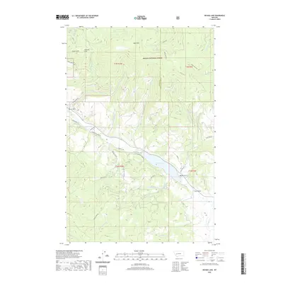
2020 Map of Nevada Lake
USGS Topo · Published 2020About this map
Nevada Lake serves as a central landmark for this portion of the Montana high country, where the waters of Nevada Creek are impounded within a landscape defined by deep gulches and significant elevation changes. The northeastern portion of the map is dominated by the Helena National Forest, featuring prominent peaks like Ogden Mtn and lookout points such as Lincoln View. The drainages of Wilson Creek, Wasson Creek, and Sauerkraut Creek carve through the northern terrain, feeding toward the broader Avon Valley to the southeast. Settlers and land managers utilized a network of forest and mountain roads, including Nevada Ogden Rd and Lower Braziel Creek Rd, to navigate the complex topography. These routes link smaller features like Braziel Lake and Cottonwood Meadow, illustrating the historic patterns of movement between the timbered highlands and the valley floors.
Find a feature on this map
45 named features on this map. Tap any name to fly to it.
Don’t see what you’re looking for? This feature index may not catch every label — zoom into the map to look around manually.
Map Details
Editions of this 2020 Nevada Lake Map
This is the sole edition of this map. No revisions or reprints were ever made.
Other maps of this area

1889 · Helena
USGS Topo · 1:250,000

1893 · Helena
USGS Topo · 1:250,000

1899 · Helena
USGS Topo · 1:250,000

1903 · Helena
USGS Topo · 1:250,000

1947 · Butte
USGS Topo · 1:250,000

1958 · Butte
USGS Topo · 1:250,000

1958 · Avon
USGS Topo · 1:62,500

1958 · Garrison
USGS Topo · 1:62,500

1960 · Butte
USGS Topo · 1:250,000

1962 · Butte
USGS Topo · 1:250,000