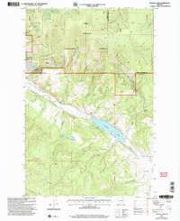
2001 Map of Nevada Lake
USGS Topo · Published 2004About this map
Helena National Forest lands dominate this mountain landscape at the boundary of Powell and Lewis and Clark Counties. The terrain is defined by high peaks like Ogden Mountain and a complex drainage network including Wasson Creek and Sauerkraut Creek. Water management is central to the area's geography, visible in the significant footprint of Nevada Lake and the engineered route of the Douglas Canal.
Find a feature on this map
36 named features on this map. Tap any name to fly to it.
Don’t see what you’re looking for? This feature index may not catch every label — zoom into the map to look around manually.
Map Details
Editions of this 2001 Nevada Lake Map
This is the sole edition of this map. No revisions or reprints were ever made.
Other maps of this area

1889 · Helena
USGS Topo · 1:250,000

1893 · Helena
USGS Topo · 1:250,000

1899 · Helena
USGS Topo · 1:250,000

1903 · Helena
USGS Topo · 1:250,000

1947 · Butte
USGS Topo · 1:250,000

1958 · Butte
USGS Topo · 1:250,000

1958 · Avon
USGS Topo · 1:62,500

1958 · Garrison
USGS Topo · 1:62,500

1960 · Butte
USGS Topo · 1:250,000

1962 · Butte
USGS Topo · 1:250,000