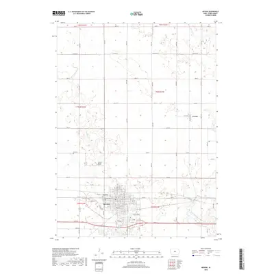
2018 Map of Nevada
USGS Topo · Published 2018About this map
The city of Nevada serves as the central hub of this Story County landscape, where an orderly grid of residential streets and commercial avenues gives way to the agricultural expanses of the Iowa heartland. The town's historical and communal footprint is well-documented through its multiple burial grounds, including the Nevada Cem, Evergreen Memory Gardens, and the Saint Patrick Catholic Cem. To the north, the small settlement of Fernald stands near the intersection of Richland St and 190th St. The terrain is defined by the winding paths of East Indian Creek and W Indian Cr, which carve through the surrounding townships. Modern infrastructure is evident in the development along Fawcett Pkwy and the transit corridors of 240th St and Co Rd E41, illustrating the area's role as a vital connection point between regional agricultural production and local commerce.
Find a feature on this map
49 named features on this map. Tap any name to fly to it.
Don’t see what you’re looking for? This feature index may not catch every label — zoom into the map to look around manually.
Map Details
Editions of this 2018 Nevada Map
This is the sole edition of this map. No revisions or reprints were ever made.
Other maps of this area

1911 · Slater
USGS Topo · 1:62,500

1912 · Ames
USGS Topo · 1:62,500

1913 · Slater
USGS Topo · 1:62,500

1914 · Ames
USGS Topo · 1:62,500

1954 · Waterloo
USGS Topo · 1:250,000

1954 · Des Moines
USGS Topo · 1:250,000

1955 · Waterloo
USGS Topo · 1:250,000

1956 · Des Moines
USGS Topo · 1:250,000

1957 · Des Moines
USGS Topo · 1:250,000

1969 · Des Moines
USGS Topo · 1:250,000