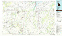
1986 Map of Nevada
USGS Topo · Published 1986About this map
Nevada and Fort Scott anchor this mid-1980s landscape across the Missouri-Kansas border, a region defined by extensive rail networks and the winding courses of the Little Osage River and Marmaton River. The map captures a moment of active resource extraction and conservation, with numerous Strip Mine operations and quarries shown alongside established nature areas like Prairie State Park and the Schell-Osage State Wildlife Area. Near the heart of the region, the Camp Clark Military Reservation stands as a notable landmark adjacent to Nevada. The presence of the Old Military Road and the National Cemetery at Fort Scott provides significant points of interest for historical and genealogical research. The transportation infrastructure is remarkably dense, featuring the Missouri Pacific Railroad and the Kansas City Southern Railroad threading through small prairie settlements such as Richards, Metz, and Montevallo.
Find a feature on this map
167 named features on this map. Tap any name to fly to it.
Don’t see what you’re looking for? This feature index may not catch every label — zoom into the map to look around manually.
Map Details
Editions of this 1986 Nevada Map
This is the sole edition of this map. No revisions or reprints were ever made.
Other maps of this area

1884 · Fort Scott
USGS Topo · 1:125,000

1885 · Garnett
USGS Topo · 1:125,000

1886 · Nevada
USGS Topo · 1:125,000

1886 · Joplin
USGS Topo · 1:125,000

1886 · Stockton
USGS Topo · 1:125,000

1886 · Greenfield
USGS Topo · 1:125,000

1886 · Iola
USGS Topo · 1:125,000

1886 · Fort Scott
USGS Topo · 1:125,000

1886 · Carthage
USGS Topo · 1:125,000

1886 · Parsons
USGS Topo · 1:125,000