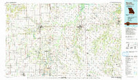
1991 Map of Nevada
USGS Topo · Published 1991About this map
The Missouri Pacific Railroad and the state line crossing define the transit-heavy character of this borderland, where the prairies of eastern Kansas meet western Missouri. Fort Scott stands as a primary hub west of the line, while Nevada serves as the central focal point in Missouri, just north of the Camp Clark Military Reservation. The landscape is a mix of agricultural plots and industrial footprints, notably the strip mines and quarries that suggest the region's extraction history. Waterways like the Little Osage River and Marmaton River wind through the terrain, leading toward larger conservation areas such as the Schell-Osage State Wildlife Area and the Harry S Truman Reservoir. For those tracing local roots, the map captures several smaller communities including Moundville, Bronaugh, and Walker, alongside rural landmarks like Bunn Cemetery.
Find a feature on this map
92 named features on this map. Tap any name to fly to it.
Don’t see what you’re looking for? This feature index may not catch every label — zoom into the map to look around manually.
Map Details
Editions of this 1991 Nevada Map
This is the sole edition of this map. No revisions or reprints were ever made.
Other maps of this area

1884 · Fort Scott
USGS Topo · 1:125,000

1885 · Garnett
USGS Topo · 1:125,000

1886 · Nevada
USGS Topo · 1:125,000

1886 · Joplin
USGS Topo · 1:125,000

1886 · Stockton
USGS Topo · 1:125,000

1886 · Greenfield
USGS Topo · 1:125,000

1886 · Iola
USGS Topo · 1:125,000

1886 · Fort Scott
USGS Topo · 1:125,000

1886 · Carthage
USGS Topo · 1:125,000

1886 · Parsons
USGS Topo · 1:125,000