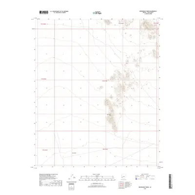
2018 Map of Neversweat Ridge
USGS Topo · Published 2018About this map
King Valley and the central uplift of Neversweat Ridge dominate this desert landscape in the southwestern reaches of Arizona. The terrain is defined by the stark isolation of the ridge line, which rises sharply from the surrounding alluvial floor within the boundaries of T4S R15W. This map document, produced in cooperation with agencies including the U.S. Geological Survey and the Bureau of Land Management, provides an exacting record of the land surface before contemporary environmental shifts. Topographic contours at ten-foot intervals trace the complex drainage patterns and elevation changes across this arid expanse, showing the natural flow toward the broader valley floor. The map is a critical reference for understanding the physical geography and public land survey system divisions in this specific portion of Yuma County.
Find a feature on this map
9 named features on this map. Tap any name to fly to it.
Don’t see what you’re looking for? This feature index may not catch every label — zoom into the map to look around manually.
Map Details
Editions of this 2018 Neversweat Ridge Map
This is the sole edition of this map. No revisions or reprints were ever made.
Other maps of this area

1928 · Norton
USGS Topo · 1:62,500

1929 · Norton
USGS Topo · 1:62,500

1930 · Stoval
USGS Topo · 1:62,500

1942 · Vicksburg
USGS Topo · 1:250,000

1950 · Stoval
USGS Topo · 1:62,500

1953 · Ajo
USGS Topo · 1:250,000

1954 · Phoenix
USGS Topo · 1:250,000

1955 · Roll
USGS Topo · 1:62,500

1957 · Ajo
USGS Topo · 1:250,000

1957 · Phoenix
USGS Topo · 1:250,000