
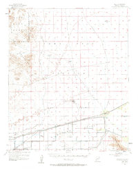
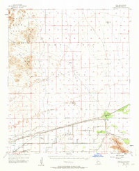
1955 Map of Roll
USGS Topo · Published 1956About this map
The Gila River corridor in southwestern Arizona is depicted here at a mid-century moment of significant agricultural and hydraulic engineering. The landscape is defined by the Mohawk Canal and Wellton-Kofa Canal, which deliver water to the valley floor near settlements like Roll and Growler. This irrigation network supported local infrastructure such as the Mohawk Valley Sch and the Terry Ranch. Away from the river, the terrain transitions sharply into the Castle Dome Mountains and the arid expanse of the Kofa Game Range. In these higher elevations, the map records the region's mining and grazing history through labels like Sheep Mine, Mesquite Jim Well, and the Renner Well. The presence of the Southern Pacific railroad line alongside the river highlights the importance of this transit route through Tyson Valley.
Find a feature on this map
37 named features on this map. Tap any name to fly to it.
Don’t see what you’re looking for? This feature index may not catch every label — zoom into the map to look around manually.
Map Details
Editions of this 1955 Roll Map
3 editions found
Other maps of this area

1926 · Wellton
USGS Topo · 1:62,500

1926 · Mohawk
USGS Topo · 1:62,500

1927 · Kim
USGS Topo · 1:62,500

1928 · Mohawk
USGS Topo · 1:62,500

1928 · Norton
USGS Topo · 1:62,500

1929 · Wellton
USGS Topo · 1:62,500

1929 · Norton
USGS Topo · 1:62,500

1930 · Stoval
USGS Topo · 1:62,500

1931 · Kim
USGS Topo · 1:62,500

1942 · Yuma
USGS Topo · 1:250,000