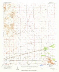
1955 Map of Roll
USGS Topo · Published 1963About this map
The Gila River corridor and the industrial landscape of the Mohawk Valley define this mid-century survey of southwestern Arizona. Agricultural development is evident along the Mohawk Canal, supported by a network of levees and family-named locations such as Terry Ranch and Tyson. The southern portion of the map centers on the small settlement of Roll, where the Mohawk Valley Sch stands as a local landmark near the Southern Pacific railroad line.
Find a feature on this map
29 named features on this map. Tap any name to fly to it.
Don’t see what you’re looking for? This feature index may not catch every label — zoom into the map to look around manually.
Map Details
Editions of this 1955 Roll Map
3 editions found

Other maps of this area

1926 · Wellton
USGS Topo · 1:62,500

1926 · Mohawk
USGS Topo · 1:62,500

1927 · Kim
USGS Topo · 1:62,500

1928 · Mohawk
USGS Topo · 1:62,500

1928 · Norton
USGS Topo · 1:62,500

1929 · Wellton
USGS Topo · 1:62,500

1929 · Norton
USGS Topo · 1:62,500

1930 · Stoval
USGS Topo · 1:62,500

1931 · Kim
USGS Topo · 1:62,500

1942 · Yuma
USGS Topo · 1:250,000