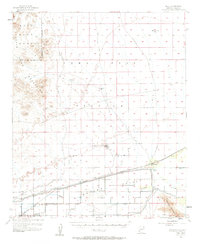
1955 Map of Roll
USGS Topo · Published 1962About this map
The Mohawk Valley landscape in the mid-1950s is defined by the critical relationship between the desert and the Gila River. Irrigation infrastructure is central to life here, with the Mohawk Canal and an extensive system of Levee protections supporting agricultural efforts near the town of Roll. The Mohawk Valley Sch and Terry Ranch serve as anchors for the local community, while the Southern Pacific railroad provides a vital transportation corridor through the valley floor.
Find a feature on this map
35 named features on this map. Tap any name to fly to it.
Don’t see what you’re looking for? This feature index may not catch every label — zoom into the map to look around manually.
Map Details
Editions of this 1955 Roll Map
3 editions found

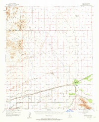
Other maps of this area

1926 · Wellton
USGS Topo · 1:62,500

1926 · Mohawk
USGS Topo · 1:62,500

1927 · Kim
USGS Topo · 1:62,500

1928 · Mohawk
USGS Topo · 1:62,500

1928 · Norton
USGS Topo · 1:62,500

1929 · Wellton
USGS Topo · 1:62,500

1929 · Norton
USGS Topo · 1:62,500

1930 · Stoval
USGS Topo · 1:62,500

1931 · Kim
USGS Topo · 1:62,500

1942 · Yuma
USGS Topo · 1:250,000