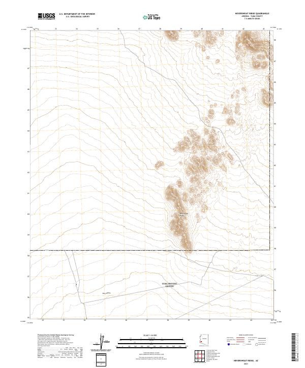
2021 Map of Neversweat Ridge
USGS Topo · Published 2021About this map
Neversweat Ridge defines the center of this 2021 landscape, a prominent geological formation that rises above the surrounding desert floor in Yuma County. To the south, the terrain levels out into the broad expanse of King Valley, which stretches across the lower portion of the sheet. The map illustrates a stark, arid environment dominated by these two primary features, showing the relief and contour patterns that characterize this part of Arizona. Produced by the U.S. Geological Survey using data from the North American Datum of 1983, the survey provides a precise layout of the township and range boundaries including t4s r15w and t5s r15w. This documentation captures the modern state of the land's surface, reflecting a region where natural topography remains the primary point of orientation.
Find a feature on this map
10 named features on this map. Tap any name to fly to it.
Don’t see what you’re looking for? This feature index may not catch every label — zoom into the map to look around manually.
Map Details
Editions of this 2021 Neversweat Ridge Map
This is the sole edition of this map. No revisions or reprints were ever made.
Other maps of this area

1928 · Norton
USGS Topo · 1:62,500

1929 · Norton
USGS Topo · 1:62,500

1930 · Stoval
USGS Topo · 1:62,500

1942 · Vicksburg
USGS Topo · 1:250,000

1950 · Stoval
USGS Topo · 1:62,500

1953 · Ajo
USGS Topo · 1:250,000

1954 · Phoenix
USGS Topo · 1:250,000

1955 · Roll
USGS Topo · 1:62,500

1957 · Ajo
USGS Topo · 1:250,000

1957 · Phoenix
USGS Topo · 1:250,000