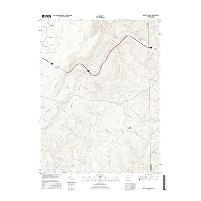
2016 Map of New Baltimore
USGS Topo · Published 2016About this map
New Baltimore sits at a topographic crossroads in the Allegheny Mountains where the Raystown Br Juniata River begins its eastward journey. This 2016 survey highlights a landscape defined by significant elevation changes, from the heights of Savage Mtn and Bearwallow Mtn to the deep cuts of the Allegheny Tunnel. The map documents the persistent settlement patterns of small communities like Glade, Glen Savage, and Mt Zion, which are linked by a network of hollow roads and ridge-top routes such as Dividing Ridge.
Find a feature on this map
58 named features on this map. Tap any name to fly to it.
Don’t see what you’re looking for? This feature index may not catch every label — zoom into the map to look around manually.
Map Details
Editions of this 2016 New Baltimore Map
This is the sole edition of this map. No revisions or reprints were ever made.
Other maps of this area

1908 · Bedford
USGS Topo · 1:62,500

1910 · Bedford
USGS Topo · 1:62,500

1914 · Windber
USGS Topo · 1:62,500

1916 · Windber
USGS Topo · 1:62,500

1923 · Berlin
USGS Topo · 1:48,000

1927 · Hyndman
USGS Topo · 1:62,500

1929 · Berlin
USGS Topo · 1:62,500

1931 · Hyndman
USGS Topo · 1:62,500

1944 · Hyndman
USGS Topo · 1:62,500

1944 · Windber
USGS Topo · 1:62,500
Featured Places
- Fairhope Township, PA
- New Baltimore, PA
- Londonderry Township, PA
- Stonycreek Township, PA
- Northampton Township, PA