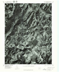
1977 Map of New Baltimore
USGS Topo · Published 1979About this map
New Baltimore occupies a tight bend of the Raystown Branch Juniata River, where the landscape transitions from river valley to the sharp elevations of Dividing Ridge. This 1977 orthophotograph, rectified from aerial imagery, provides a detailed visual record of the land use patterns in Somerset County during the late 1970s. The map captures the patchwork of agricultural clearings and dense forest cover surrounding smaller settlements like Mt Zion and Glen Savage. This specific format—an orthophotoquad—replaces traditional topographic lines with actual photographic detail, allowing researchers to see exact fence lines, building footprints, and the precise density of the woods in areas such as Glade. It is an essential resource for understanding how rural Pennsylvania was partitioned and farmed before modern suburban expansion or reforestation altered these family-held tracts.
Find a feature on this map
6 named features on this map. Tap any name to fly to it.
Don’t see what you’re looking for? This feature index may not catch every label — zoom into the map to look around manually.
Map Details
Editions of this 1977 New Baltimore Map
This is the sole edition of this map. No revisions or reprints were ever made.
Other maps of this area

1908 · Bedford
USGS Topo · 1:62,500

1910 · Bedford
USGS Topo · 1:62,500

1914 · Windber
USGS Topo · 1:62,500

1916 · Windber
USGS Topo · 1:62,500

1923 · Berlin
USGS Topo · 1:48,000

1927 · Hyndman
USGS Topo · 1:62,500

1929 · Berlin
USGS Topo · 1:62,500

1931 · Hyndman
USGS Topo · 1:62,500

1944 · Hyndman
USGS Topo · 1:62,500

1944 · Windber
USGS Topo · 1:62,500
Featured Places
- Fairhope Township, PA
- New Baltimore, PA
- Stonycreek Township, PA
- Glen Savage, Allegheny Township
- Glade, Stonycreek Township