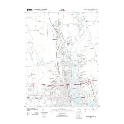
2012 Map of New Bedford North
USGS Topo · Published 2012About this map
The Acushnet River serves as the central artery for this coastal Massachusetts landscape, separating the bustling waterfront of Fairhaven and Oxford from the dense residential and industrial core of New Bedford Harbor. This 2012 edition documents a region deeply connected to its maritime and aviation infrastructure, featuring the Massachusetts State Pier, the Acushnet River Seaplance Base, and the New Bedford Regional Airport. To the north, the terrain transitions into a mosaic of planned residential developments like Sherwood Forest and Inland Park, interspersed with numerous historic burial grounds such as Saint Marys Cem and the Long Plain Cemeteries. This proximity of modern transit hubs to venerable local sites provides a clear view of how 21st-century growth has integrated with the established settlements of Plainville and North Fairhaven.
Find a feature on this map
314 named features on this map. Tap any name to fly to it.
Don’t see what you’re looking for? This feature index may not catch every label — zoom into the map to look around manually.
Map Details
Editions of this 2012 New Bedford North Map
This is the sole edition of this map. No revisions or reprints were ever made.
Other maps of this area

1885 · New Bedford
USGS Topo · 1:62,500

1885 · Middleboro
USGS Topo · 1:62,500

1885 · Taunton
USGS Topo · 1:62,500

1888 · New Bedford
USGS Topo · 1:62,500

1888 · Fall River
USGS Topo · 1:62,500

1888 · Taunton
USGS Topo · 1:62,500

1888 · Middleboro
USGS Topo · 1:62,500

1893 · Taunton
USGS Topo · 1:62,500

1893 · Middleboro
USGS Topo · 1:62,500

1893 · Fall River
USGS Topo · 1:62,500