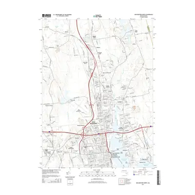
2015 Map of New Bedford North
USGS Topo · Published 2015About this map
The maritime legacy of New Bedford is anchored by the New Bedford Whaling National Historic Park near the waterfront of the Acushnet River. This 2015 survey reveals a densely developed urban core surrounded by established neighborhoods like Rockdale, Mount Pleasant, and Coury Heights. The landscape transitions from the industrial and residential grid of the city to the suburban and rural fringes of North Dartmouth and Acushnet. Genealogists will find a wealth of burial grounds recorded, ranging from the large Oak Grove Cem to the Long Plain Cemeteries and Peckham West Cem. Regional infrastructure is highlighted by the New Bedford Regional Airport, while significant green spaces like Inland Park and Westgate Park are integrated into the northern developments of Clifford and Pine Hill Acres.
Find a feature on this map
313 named features on this map. Tap any name to fly to it.
Don’t see what you’re looking for? This feature index may not catch every label — zoom into the map to look around manually.
Map Details
Editions of this 2015 New Bedford North Map
This is the sole edition of this map. No revisions or reprints were ever made.
Other maps of this area

1885 · New Bedford
USGS Topo · 1:62,500

1885 · Middleboro
USGS Topo · 1:62,500

1885 · Taunton
USGS Topo · 1:62,500

1888 · New Bedford
USGS Topo · 1:62,500

1888 · Fall River
USGS Topo · 1:62,500

1888 · Taunton
USGS Topo · 1:62,500

1888 · Middleboro
USGS Topo · 1:62,500

1893 · Taunton
USGS Topo · 1:62,500

1893 · Middleboro
USGS Topo · 1:62,500

1893 · Fall River
USGS Topo · 1:62,500