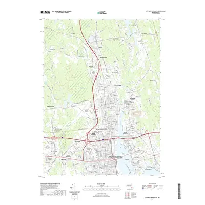
2021 Map of New Bedford North
USGS Topo · Published 2021About this map
The Acushnet River corridor serves as the primary artery through this industrial and coastal landscape, connecting the urban centers of New Bedford and Fairhaven with the interior swamps and reservoirs. The shoreline is defined by historic maritime sites, notably the New Bedford Whaling National Historical Park and the port areas of Oxford and Harbor View. Large-scale infrastructure, including the New Bedford Regional Airport and the University of Massachusetts School of Law Dartmouth, exists alongside extensive natural conservation areas like the Acushnet Cedar Swamp and Bolton Cedar Swamp. Genealogists will find a dense concentration of burial grounds, including the Ancient Long Plain Cem and Long Plain Quaker Cem, which reflect the early Quaker influence in the region. The map also traces the transition from dense urban grids to suburban neighborhoods such as Sherwood Forest and Pine Hill Acres.
Find a feature on this map
295 named features on this map. Tap any name to fly to it.
Don’t see what you’re looking for? This feature index may not catch every label — zoom into the map to look around manually.
Map Details
Editions of this 2021 New Bedford North Map
This is the sole edition of this map. No revisions or reprints were ever made.
Other maps of this area

1885 · New Bedford
USGS Topo · 1:62,500

1885 · Middleboro
USGS Topo · 1:62,500

1885 · Taunton
USGS Topo · 1:62,500

1888 · New Bedford
USGS Topo · 1:62,500

1888 · Fall River
USGS Topo · 1:62,500

1888 · Taunton
USGS Topo · 1:62,500

1888 · Middleboro
USGS Topo · 1:62,500

1893 · Taunton
USGS Topo · 1:62,500

1893 · Middleboro
USGS Topo · 1:62,500

1893 · Fall River
USGS Topo · 1:62,500