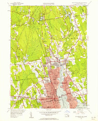
1948 Map of New Bedford North
USGS Topo · Published 1958About this map
The Acushnet River serves as a central artery for this coastal region, dividing the industrial landscape of New Bedford from the residential and maritime reaches of Fairhaven. By the late 1940s, the urban core was densely packed with civic institutions, including the Whaling Museum and Vocational School, while the waterfront featured specialized sites like the State Pier and the defensive grounds of Fort Phoenix.
Find a feature on this map
109 named features on this map. Tap any name to fly to it.
Don’t see what you’re looking for? This feature index may not catch every label — zoom into the map to look around manually.
Map Details
Editions of this 1948 New Bedford North Map
This is the sole edition of this map. No revisions or reprints were ever made.
Other maps of this area

1885 · New Bedford
USGS Topo · 1:62,500

1885 · Middleboro
USGS Topo · 1:62,500

1885 · Taunton
USGS Topo · 1:62,500

1888 · New Bedford
USGS Topo · 1:62,500

1888 · Fall River
USGS Topo · 1:62,500

1888 · Taunton
USGS Topo · 1:62,500

1888 · Middleboro
USGS Topo · 1:62,500

1893 · Taunton
USGS Topo · 1:62,500

1893 · Middleboro
USGS Topo · 1:62,500

1893 · Fall River
USGS Topo · 1:62,500