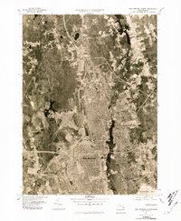
1977 Map of New Bedford North
USGS Topo · Published 1981About this map
The Acushnet River corridor serves as the central anchor for this 1970s orthophotoquad, revealing the dense residential and industrial footprint of New Bedford and Fairhaven as they appeared in the late twentieth century. Unlike traditional line-drawn maps, this aerial imagery provides a direct view of the urban grid and its relationship to the waterfront at Buzzards Bay. To the north, the landscape transitions into a more fragmented pattern of woodlands and clearings around Braleys and Long Plain, illustrating the historical northward expansion of the New Bedford area.
Find a feature on this map
10 named features on this map. Tap any name to fly to it.
Don’t see what you’re looking for? This feature index may not catch every label — zoom into the map to look around manually.
Map Details
Editions of this 1977 New Bedford North Map
This is the sole edition of this map. No revisions or reprints were ever made.
Other maps of this area

1885 · New Bedford
USGS Topo · 1:62,500

1885 · Middleboro
USGS Topo · 1:62,500

1885 · Taunton
USGS Topo · 1:62,500

1888 · New Bedford
USGS Topo · 1:62,500

1888 · Fall River
USGS Topo · 1:62,500

1888 · Taunton
USGS Topo · 1:62,500

1888 · Middleboro
USGS Topo · 1:62,500

1893 · Taunton
USGS Topo · 1:62,500

1893 · Middleboro
USGS Topo · 1:62,500

1893 · Fall River
USGS Topo · 1:62,500