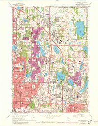
1967 Map of New Brighton
USGS Topo · Published 1973About this map
The Twin Cities Army Ammunition Plant dominates the northern landscape of this suburban Minnesota region, reflecting the significant military-industrial footprint in the area during the mid-20th century. Suburban expansion is visible across New Brighton, Mounds View, and Arden Hills, with newer urban developments highlighted in purple revisions. Transport and logistics are anchored by the Soo Line and Burlington Northern railroads, which weave through a lakeland terrain featuring Lake Johanna, Turtle Lake, and Lake Owasso. Education and institutional history are well-represented by Bethel Seminary, Nazareth Hall, and numerous regional schools. This survey captures a moment of transition where industrial sites, such as sandpits and the Twin City Speedway, coexist with expanding residential neighborhoods and established local burial grounds like Sunset Memorial Park Cemetery and Roselawn Cem.
Find a feature on this map
102 named features on this map. Tap any name to fly to it.
Don’t see what you’re looking for? This feature index may not catch every label — zoom into the map to look around manually.
Map Details
Editions of this 1967 New Brighton Map
5 editions found



Other maps of this area

1896 · Minneapolis
USGS Topo · 1:62,500

1896 · St. Paul
USGS Topo · 1:62,500

1901 · Minneapolis
USGS Topo · 1:62,500

1902 · White Bear
USGS Topo · 1:62,500

1902 · Anoka
USGS Topo · 1:62,500

1951 · St. Paul West
USGS Topo · 1:24,000

1951 · St. Paul East
USGS Topo · 1:24,000

1951 · St. Paul
USGS Topo · 1:62,500

1952 · Centerville
USGS Topo · 1:24,000

1952 · White Bear Lake West
USGS Topo · 1:24,000