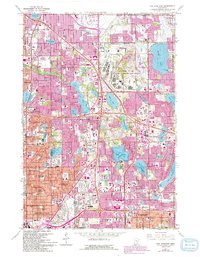
1967 Map of New Brighton
USGS Topo · Published 1993About this map
The Twin Cities Army Ammunition Plant occupies a massive footprint in this landscape, a significant federal presence amidst the rapid suburbanization of the late 1960s. This survey records the expansion of New Brighton, Arden Hills, and Shoreview, where residential developments are beginning to fill the spaces between numerous glacial lakes like Turtle Lake and Lake Johanna. The map captures a high density of educational and religious institutions, including Bethel Seminary and Nazareth Hall, alongside numerous schools such as Mounds View High Sch and Spring Lake Park Sch. Along the southwestern edge, the urban grid of Minneapolis and Columbia Heights is fully established, marked by large cemeteries like Hillside Cemetery and St Anthony Cem. Extensive purple-tinted areas from a 1991 revision illustrate the late-century growth that transformed former woodland and fields into the modern Twin Cities metro.
Find a feature on this map
102 named features on this map. Tap any name to fly to it.
Don’t see what you’re looking for? This feature index may not catch every label — zoom into the map to look around manually.
Map Details
Editions of this 1967 New Brighton Map
5 editions found

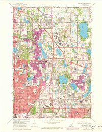


Other maps of this area

1896 · Minneapolis
USGS Topo · 1:62,500

1896 · St. Paul
USGS Topo · 1:62,500

1901 · Minneapolis
USGS Topo · 1:62,500

1902 · White Bear
USGS Topo · 1:62,500

1902 · Anoka
USGS Topo · 1:62,500

1951 · St. Paul West
USGS Topo · 1:24,000

1951 · St. Paul East
USGS Topo · 1:24,000

1951 · St. Paul
USGS Topo · 1:62,500

1952 · Centerville
USGS Topo · 1:24,000

1952 · White Bear Lake West
USGS Topo · 1:24,000