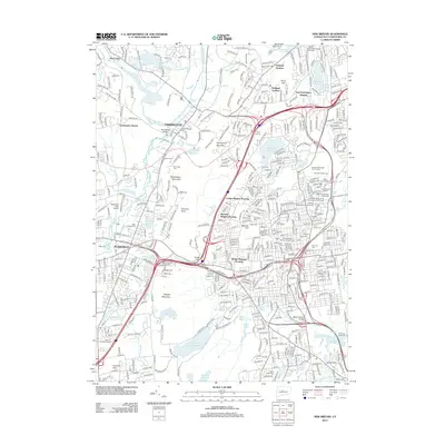
2012 Map of New Britain
USGS Topo · Published 2012About this map
Farmington and Plainville serve as anchor points in this landscape defined by a dense network of suburban development and industrial infrastructure. The terrain is marked by prominent ridges such as Rattlesnake Mountain and Bradley Mountain, which channel the flow of the Quinnipiac River and Pequabuck River. A high concentration of historic cemeteries, including the Old Farmington Cem and Old Saint Mary Roman Catholic Cem, provides deep genealogical value for researchers tracing long-standing community roots. The presence of Connecticut University and several distinct housing developments like Pinnacle Heights Housing reflects the late-20th-century expansion of the region. Significant water management features, notably the Shuttle Meadow Reservoir and Wassel Reservoir, underscore the importance of local water resources for the surrounding municipalities, while Robertson Field Airport highlights the area's role in local aviation and transport.
Find a feature on this map
75 named features on this map. Tap any name to fly to it.
Don’t see what you’re looking for? This feature index may not catch every label — zoom into the map to look around manually.
Map Details
Editions of this 2012 New Britain Map
This is the sole edition of this map. No revisions or reprints were ever made.
Other maps of this area

1892 · Hartford
USGS Topo · 1:62,500

1892 · Meriden
USGS Topo · 1:62,500

1892 · Granby
USGS Topo · 1:62,500

1893 · Middletown
USGS Topo · 1:62,500

1893 · Meriden
USGS Topo · 1:62,500

1906 · Farmington
USGS Topo · 1:125,000

1928 · Cromwell
USGS Topo · 1:24,000

1928 · Windsor
USGS Topo · 1:24,000

1944 · Hartford South
USGS Topo · 1:31,680

1945 · Hartford North
USGS Topo · 1:31,680