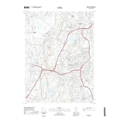
2018 Map of New Britain
USGS Topo · Published 2018About this map
Metacomet Ridge and the Quinnipiac River define the central spine of this landscape, separating the dense urban fabric of New Britain from the suburban stretches of Farmington and Plainville. The map reveals a complex network of reservoirs and water bodies crucial to the region's development, including Shuttle Meadow Reservoir, Batterson Park Pond, and the Farmington Reservoir. Genealogists will find a high concentration of burial grounds, from the Old Farmington Cem to the ethnically diverse sites like the Polish National Catholic Cem and Russian Orthodox Cem. Educational and infrastructure hubs are prominently marked, including the Central Connecticut State University campus and Robertson Field, alongside significant transportation landmarks like the Pequabuck Bridge and Beech Swamp Bridge.
Find a feature on this map
72 named features on this map. Tap any name to fly to it.
Don’t see what you’re looking for? This feature index may not catch every label — zoom into the map to look around manually.
Map Details
Editions of this 2018 New Britain Map
This is the sole edition of this map. No revisions or reprints were ever made.
Other maps of this area

1892 · Hartford
USGS Topo · 1:62,500

1892 · Meriden
USGS Topo · 1:62,500

1892 · Granby
USGS Topo · 1:62,500

1893 · Middletown
USGS Topo · 1:62,500

1893 · Meriden
USGS Topo · 1:62,500

1906 · Farmington
USGS Topo · 1:125,000

1928 · Cromwell
USGS Topo · 1:24,000

1928 · Windsor
USGS Topo · 1:24,000

1944 · Hartford South
USGS Topo · 1:31,680

1945 · Hartford North
USGS Topo · 1:31,680